-
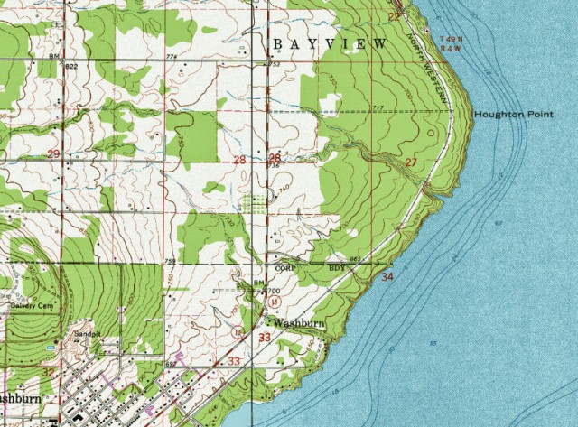
Topographic Map of Houghton Falls Nature Perserve and Vicinity- Washburn, Wisonsin
-
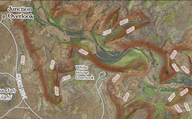
Digital Topographic Map of White House Ruins Area, Canyon de Chelly National Monument – Chinle, Arizona
Canyon de Chelly National Monument
Map of Canyon de Chelly National Monument
Canyon de Chelly National Monument (Wikipedia entry)
US Topo, the next generation of digital topographic maps from the USGS
USGS Store for downloading free topographic maps
Weather forecast for Chinle, Arizona vicinity
Blog entries for Canyon de Chelly National Monument
-
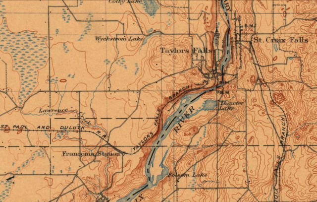
1900 Historical Topographic Map of St. Croix Dalles, Interstate Park – St. Croix Falls, Wisconsin
Map of Interstate Park (PDF file)
Dalles of the St. Croix State Natural Area
USGS Store for topographic maps and other maps
Saint Croix National Scenic Riverway
Blog entries for the Saint Croix National Scenic Riverway
Weather forecast for the St. Croix Falls, WI
Blog entries for Interstate Park
-
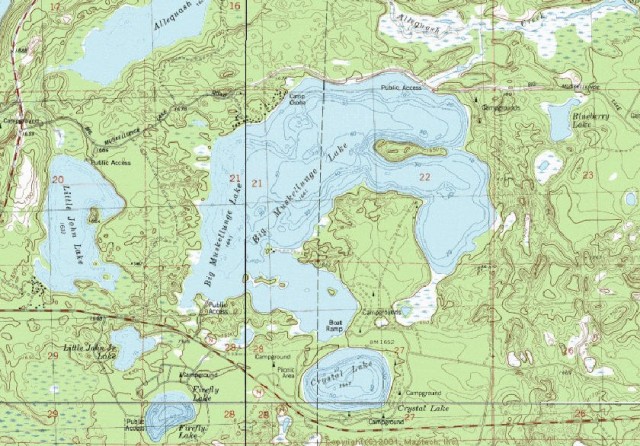
Topographic Map of Big Musky Lake, Northern Highland-American Legion State Forest – Boulder Junction, WI
Northern Highland-American Legion State Forest
Map of Big Muskellunge Lake (PDF file)
Maps of the Northern Highland-American Legion State Forest
USGS Store for topographic maps and other maps
Blog entries for Big Muskellunge Lake
Blog entries for the Northern Highland-American Legions State Forest
Weather forecast for Boulder Junction, Wisconsin vicinity
-
Topographic Map of Bear Canyon, Coronado National Forest – Tucson, Arizona
-
Topographic Map of Catalina State Park Vicinty – Tucson, Arizona
-
Topographic Map of McKittrick Canyon, Guadalupe Mountains National Park – Salt Flat, Texas
Guadalupe Mountains National Park
McKittrick Canyon in Guadalupe Mountains National Park
Map of Guadalupe Mountains National Park (PDF file)
USGS Store for free downloading of topographic maps
Weather forecast for Pine Springs, Guadalupe Mountains National Park vicinity
Blog entries for Guadalupe Mountains National Park
-
Digital Topographic Map of Twin Valley Lake, Governor Dodge State Park – Dodgeville, Wisconsin
Map of Governor Dodge State Park
Trails at Governor Dodge State Park
US Topo, the next generation of digital topographic maps from the USGS
USGS Store for downloading free topographic maps
Weather forecast for Dodgeville, Wisconsin vicinity
Blog entries for Twin Valley Lake
Blog entries for Governor Dodge State Park


