-
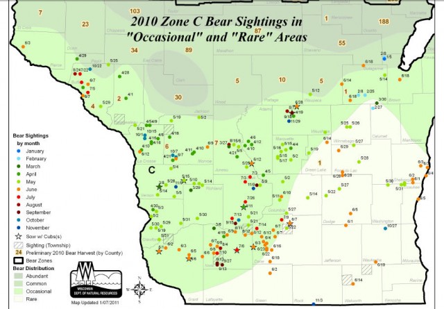
Bear Sightings during 2010 in the Southern Half of Wisconsin
Black Bear Population Status and Distribution
Crossing Paths with Bears (WI Natural Resources Magazine)
Free Trail Maps and Guides from the Wisconsin Department of Tourism
Wisconsin maps at the Wisconsin State Cartographer’s site
USGS Store for topographic maps and other maps
Blog entries for Wisconsin maps
-
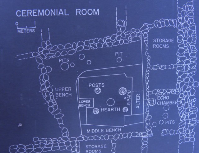
Map of Ceremonial Room, Besh Ba Gowah Archeological Park – Globe, Arizona
-
Map of Long Lake Campground, Kettle Moraine State Forest-Northern Unit – Campbellsport, Wisconsin
Kettle Moraine State Forest, Northern Unit
USGS Store for downloading free topographic maps
Map of Kettle Moraine State Forest, Northern Unit
Blog entries for Long Lake in the Kettle Moraine State Forest
Blog entries for Kettle Moraine State Forest, Northern Unit
Weather forecast for Campbellsport, Wisconsin vicinity
-
Map of Obsidian Distribution, Casa Grande Ruins National Monument – Coolidge, Arizona
-
Trails Map, Devil’s Lake State Park – Baraboo, Wisconsin
-
Distribution Map of Wisconsin Wolf Packs
-
Cougar Sitings in Wisconsin (December, 2009 to June, 2010)
Photos and videos of Cougars in Wisconsin
Wisconsin Geologic and Natural History Survey
Free Trail Maps and Guides from the Wisconsin Department of Tourism
Wisconsin maps at the Wisconsin State Cartographer’s site
USGS Store for topographic maps and other maps
Blog entries for Wisconsin maps
-
Map of Wisconsin Water Basins
Wisconsin DNR Gateway to Basins and Watersheds
Wisconsin Geologic and Natural History Survey
Free Trail Maps and Guides from the Wisconsin Department of Tourism
Wisconsin maps at the Wisconsin State Cartographer’s site
USGS Store for topographic maps and other maps
Blog entries for Wisconsin maps


