WI Maps
-
Nautical Chart of Apostle Islands – Bayfield County, Wisconsin
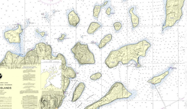
(Frog Bay is to the left of Oak Island near the center of the photograph)NOAA Office of Coast Survey Nautical Chart for the Apostle Islands
Nautical Chart Online Viewer for the Great Lakes
Weather forecast for Red Cliff, WI vicinity
Blog entries for Frog Bay Tribal National Park
-
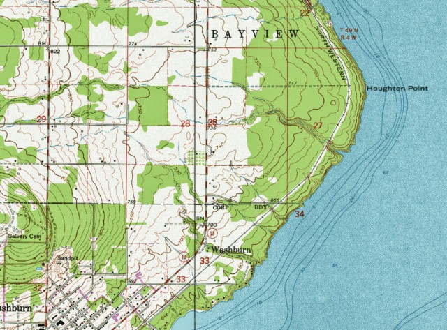
Topographic Map of Houghton Falls Nature Perserve and Vicinity- Washburn, Wisonsin
-
Map of Wisconsin Iron Ore Resources (1976)
Wisconsin Geological and Natural History Survey
Publications and Maps at the Wisconsin Geological and Natural History Survey
Wisconsin maps at the Wisconsin State Cartographer’s site
USGS Store for topographic maps and other maps
Blog entries for Wisconsin maps
-
Map, Colton’s Wisconsin 1859 (Wisconsin State Historical Society)
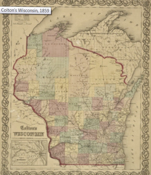
(“Any map may be printed or downloaded at no cost for nonprofit educational use by teachers and students, or for private use by individual researchers. Nothing may be reproduced in any format for commercial purposes without prior permission from the Wisconsin Historical Society.”)Map of Colton’s Wisconsin 1859 (Wisconsin State Historical Society)
Wisconsin Historical Society, Map and Atlas Collection
Wisconsin maps at the Wisconsin State Cartographer’s site
USGS Store for topographic maps and other maps
Blog entries for Wisconsin maps
-
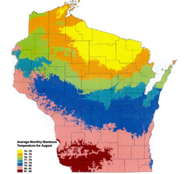
Wisconsin’s Average Monthly Temperatures for August
Wisconsin Geological and Natural History Survey
Publications and Maps at the Wisconsin Geological and Natural History Survey
Wisconsin maps at the Wisconsin State Cartographer’s site
USGS Store for topographic maps and other maps
Blog entries for Wisconsin maps
-
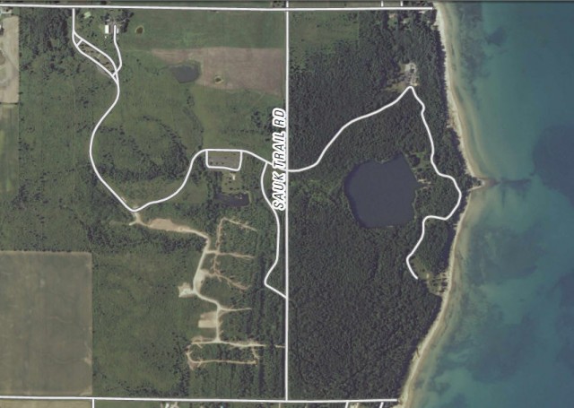
Orthoimage Map of Harrington Beach State Park – Belgium, Wisconsin
Map of Harrington Beach State Park (PDF File)
US Topo, the next generation of digital topographic maps from the USGS
Definition of orthoimage (Wikipedia entry)
USGS Store for downloading free topographic maps
Weather forecast for Belgium, Wisconsin vicinity
Blog entries for Harrington Beach State Park
-
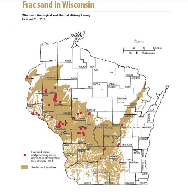
Map of Frac Sand in Wisconsin
Frac Sand in Wisconsin factsheet (PDF file)
Wisconsin Geological and Natural History Survey
Publications and Maps at the Wisconsin Geological and Natural History Survey
Wisconsin maps at the Wisconsin State Cartographer’s site
USGS Store for topographic maps and other maps
Blog entries for Wisconsin maps
-
Orthoimage Map of Willow River State Park – Hudson, Wisconsin
Map of Willow River State Park (PDF file)
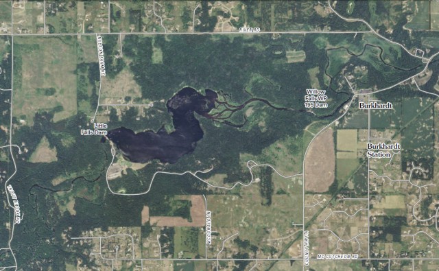
Map of Little Falls Lake (PDF File)
US Topo, the next generation of digital topographic maps from the USGS
Definition of orthoimage (Wikipedia entry)
USGS Store for downloading free topographic maps
Weather forecast for Hudson, Wisconsin vicinity
Blog entries for Willow River State Park
